
One of the great delights of my life–that thing, I say, that no one can ever take away–is to have lived, and ridden my bike, in Northern California. When I was young, I loved to bike and dreamed of crossing great distances on my ten-speed. But my meditations never brought me to this place. I could not have imagined it. But now I have had a chance to see it, to ride it, to experience a fantastic beauty that I wish more people could experience.
So, without further comment, here are five of my favorite rides in Northern California. Three of them are done best on road bikes, one is best by mountain bike, and the third is your choice (I have done both but prefer a mountain bike).
Click on the ride name to get “Ride with GPS” route instructions
Right off the bat, I must apologize for the starting places of these rides. Some start from my house or my friend Andy’s house in the Outer Sunset neighborhood of San Francisco. You should be able to figure out your own start. This one starts at my house.
Except for the ride to West Sacramento, this is one of the most interesting and beautiful rides in the County. While the River Road just south of West Sacramento can be busy at times, if you do this ride on a Sunday you are likely to have only four or five cars pass you by the time you reach Clarksburg, and then you will have 20 miles of almost no traffic at all.
I would check with the wind speed and direction before heading out because a southern wind over about 15 miles per hour can make this a tough ride until you head north and the wind will only build the further south you go.
This ride has a ferry crossing!

The 20+ miles from Clarksburg to the ferry on SR84 are among the most beautiful anywhere, passing vineyards, and row crop fields for miles. Summer can be a great time to do this but fall is amazing.
If someone picks you up in Rio Vista you have had a great ride. But if you head back north you will go through what I think of as the heart of the agricultural delta, and, if the wind is behind you, you will fly home.
Warning: Crossing the Hastings Island Bridge is trespassing. I did it, got away with it… but I can’t guarantee you won’t have problems. My experience is that most people give cyclists a pass. No promises.
The name of this one comes from a club ride (the club is from San Rafael I think), that I got to go to with my friend Dave Reynolds. This particular configuration is not the actual Huffmaster route but pretty close. This is the ride you can do with a road bike (700×30 tires please) but might be more fun on a mountain bike.
If you have not been over to this part of the coastal hills not too far from Clear Lake, CA, and not too far from Williams, CA, I highly recommend it. The valley is secluded, there is no traffic on the roads and you get to ride through the open range for parts of it.
Unlike the perfectly flat Delta Ride, this one has a fair amount of climbing–about 3000 feet–but it also has a long descent.
Leaving Leesville you are on gravel for about 10 miles and then nicely paved roads as you climb to your first summit. Then is a mostly downhill section that goes on for about 9 more.
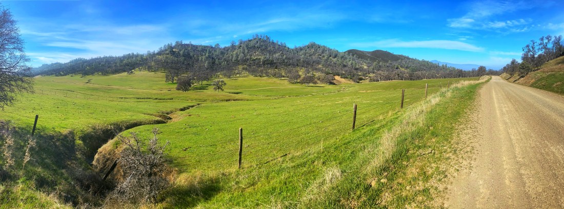
There are eagles and wildlife in this section. You bottom out in Sites, the location of a future reservoir that will close this area off from biking if it is ever built. You then began a long “fire-road-like” climb through pastures, rangeland, and typical coastal hills forest. The fire road is not too bad.
Do this ride in fall. In summer it can get pretty hot and most of it is out in the open. In spring the climb out of Sites is muddy and may be impassable. Autumn is perfect because there are lots of colors and the air is clear.
This is one of the most beautiful, never heard of rides in Northern California, but you do have to drive to get to the start.
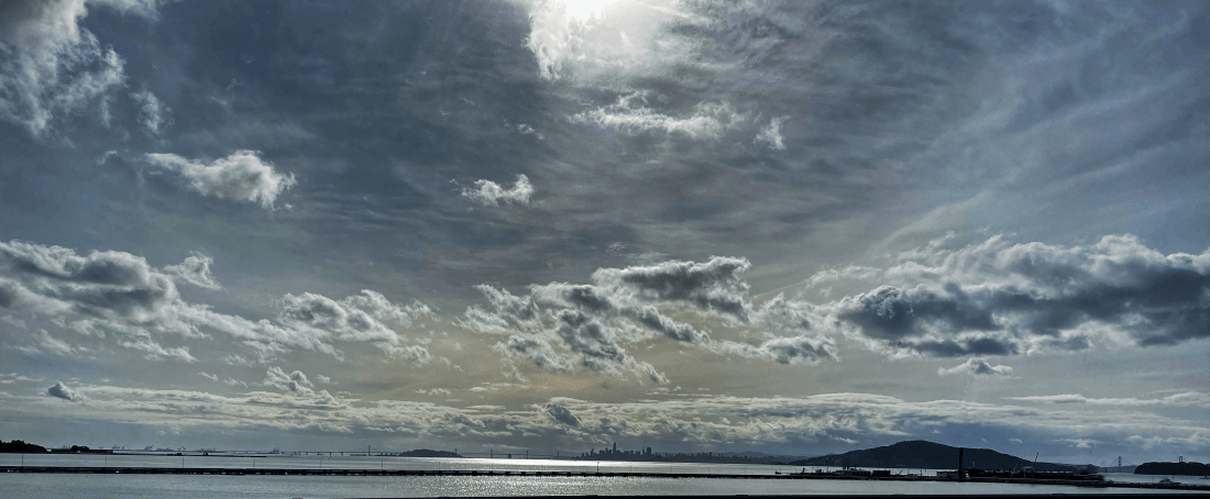
Ride with GPS has added this ride to their “Great Community Route Celebration” list! If you want to see the Bay–actually the “Bays” Grizzly to San Pablo to San Francisco–this is your route. It crosses these bays four times on interstates and Highway 101, with great views at every crossing. In between, you get to view the coastal hills and Mount Tam (see below). The crossing of the San Rafael bridge (bridge 3) affords amazing views of San Francisco.
You have to get to Martinez, CA to start this one but a train is an option. All the crossings are via dedicated and separated bike lanes, which makes for low-stress riding and plenty of opportunities to look around.
My favorite crossing is the Carquinez Bridge (bridge 2) because it provides great views of Mount Tamalpais and a large swath of the Bay. Amtrak trains pass under the bridge.

Besides the bridges themselves, the ride from Pinole to Richmond is one of the most beautiful. It passes mostly right along the bay at water level on dedicated bike paths and then out to Pinole Regional Park.
It is a bit tricky to find your way after you leave the San Rafael bridge but once you do you have to navigate some urban spaces before getting on bike paths that take you all the way to Sausilito. This ride is challenging at 4000 feet of climbing but the hills are spaced out.
I recommend a weekday for this ride in any season. Get out early and enjoy the varied microclimates as you go.
This one starts and ends at my friend Andy’s house so… figure it out. You can leave from anywhere in San Francisco. Now I realize that this ride shares some things in common with the Four Bay Bridges ride but, well, I kept it because 1) I love the Bay area; and 2) it has the most fun stretch of riding in Northern California.
Let me explain. I am from back east and rolling hills are the norm. Believe it or not they are hard to find in Northern California. It is either flat or quite hilly, but there are few stretches where it consistently goes up and down for miles. This ride has rolling hills!
When you leave Tiburon to head north along the Bay you have about 9 miles of sharp turns that rise and fall at a rhythm that make you feel like you are flying. I love this section through wooded hillsides. The views are not great but so what? You are flying!

The ride out along the west side of the Tiburon peninsula is pretty nice with, again, great views of San Francisco, and you can interrupt the trip and take your bike on a ferry out to Angel Island for a ride if you want (recommended!).
Finally, if you want a bit more of a challenge, when you get back to Mill Valley on the return, head up Evergreen to Panorama Drive and then down into Muir Woods and then back up Route 1 and back to Mill Valley. That is a hard stretch but it adds the Pacific ocean and great biking. I know lots of people do not like Route 1 but the climb up from Muir Beach is challenging, beautiful and the cars that do pass you are going very slowly. Trust me, and take the plunge.
Mountain Bike to Tam Fire Road and Back
This is a VERY tiring ride. This is 5000 feet of climbing in four steep sections (the third is the steepest), with the final LONG climb on a single track with lots of ruts. It takes you to the shoulder of Mt Tam and is the most amazing ride of the group. It is a kind of “once-a-year ride that you do on Wednesday morning if you can. If you do it on a weekend you will meet avid (young) mountain bikers screaming down at you from Tam and it will not be fun.
I have this one starting and ending at the waterfront near the Transbay Terminal. This ride is all about the Marin Headlands. It has amazing views EVERYWHERE–EVERYWHERE. The ride up from the Golden Gate seems challenging but it turns out to be the easiest climb. Once you get to the Coastal Trail you are off-road for most of the rest of the way. You split time between fire roads and some non-technical singletrack.

Riding across this part of Marin can make you feel like you are on a lonely Irish coast.
The ride takes you over several hills until you reach Tennessee Beach and then you get the steep climb up to Coyote Ridge. I have done most of this ride without a mountain bike but you will not make this climb without it. You cannot stand on your pedals here because you will lose traction and over you will go.
Expect to ride about 3 miles per hour up this climb but you will be rewarded by any hikers who will look at you with awe (or perhaps they will think you are crazy).
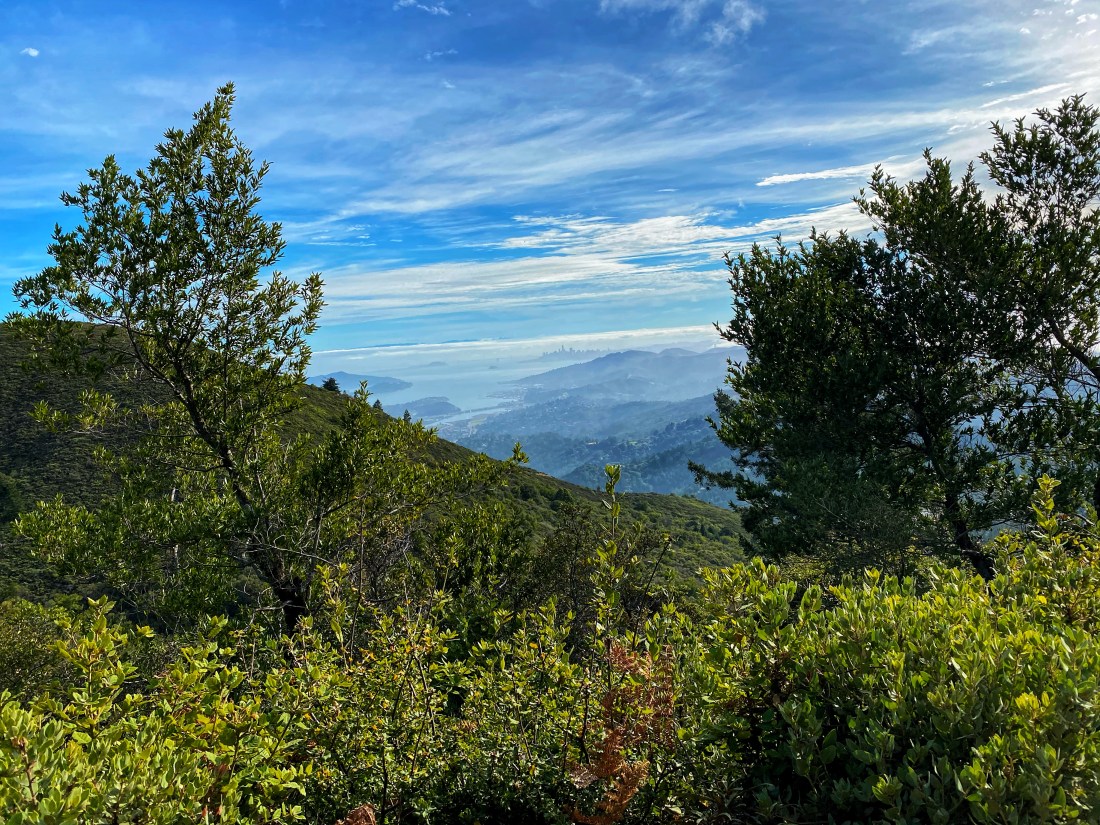 Once you get up, you have to head down to Muir Beach and this is no easy task. But then you get to climb again all the way to the shoulder of Mt Tam. This is a long hard climb but… did I mention views? Mountains and seashore and open pasture and you get to see it all from your bike. And by the time you get West Point Inn on the shoulder, before heading back, you get views of Mt Diablo, San Francisco and the entire bay.
This ride is so challenging, so tiring, but so achingly beautiful that you will never forget it. And you will be able to say, like me, no one can take that away from me.
Enjoy the ride.
